That sort of data actually is available these days, from brokers like Inrix that collect it from cellphone signals and traffic cameras and such.
Departments of Transportation trying to measure the impact of a specific project are still more likely to do it the semi-old-fashioned way, with traffic studies before and after, though.

How do you figure?
Dude with a radar gun or two coils under the pavement.
At every single location in the city?
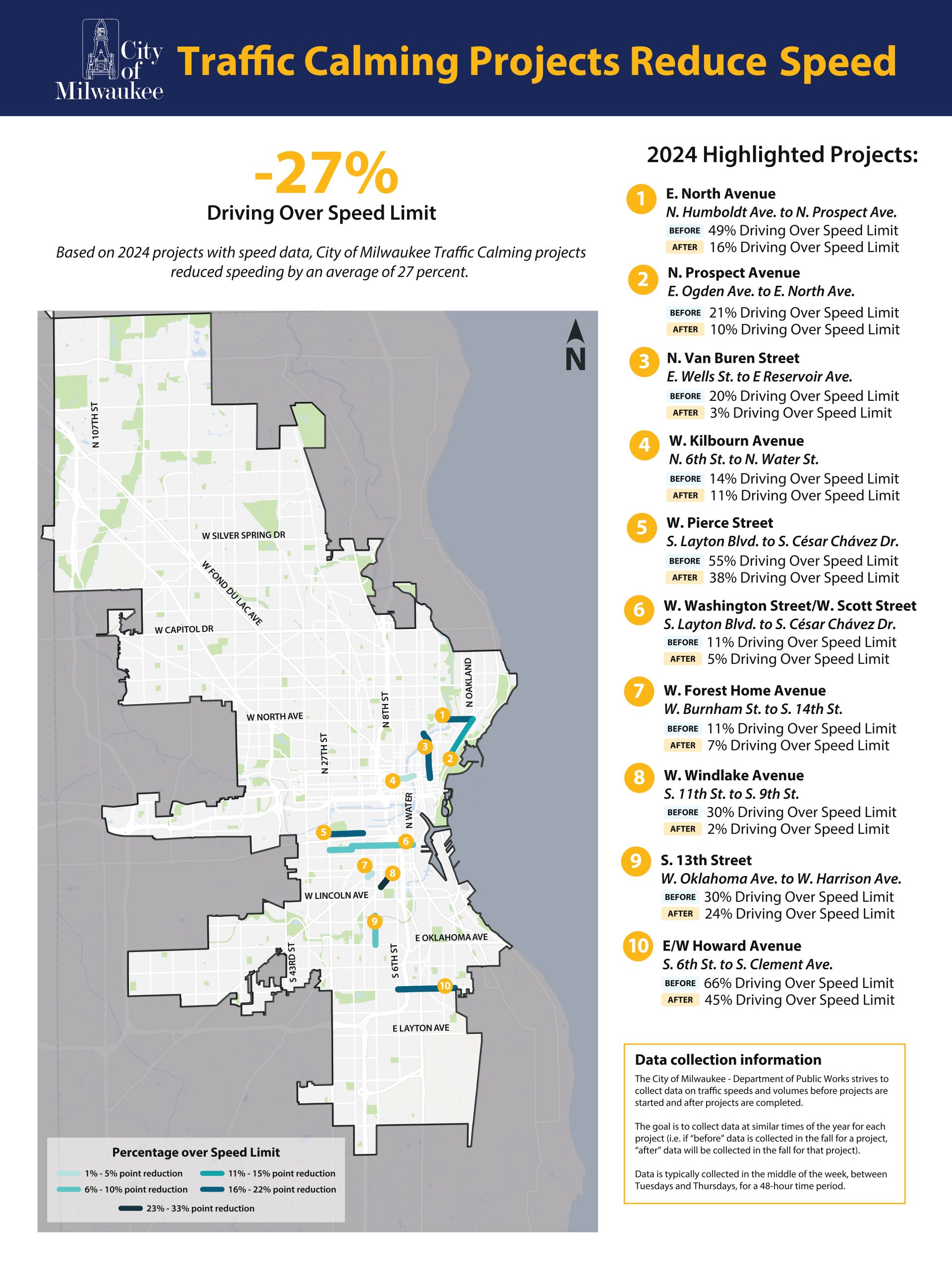
At the 10 locations posted in the OP. Data is collected at the same time each year, and over a 48-hour period.
It’s very easy to do, and since the number of vehicles recorded is often in the thousands, the trends would be very easy to see.
That sort of data actually is available these days, from brokers like Inrix that collect it from cellphone signals and traffic cameras and such.
Departments of Transportation trying to measure the impact of a specific project are still more likely to do it the semi-old-fashioned way, with traffic studies before and after, though.