

Give me a map of water systems and I will give you sensible borders.

I love this image. The choice of coloring schemes and the fractal nature of the patterns is mesmerizing.
So do all the watersheds that don’t go to the seas just end in salten lakes?
Also, what’s up with the areas with parallel lines? Open desert?
The parallel lines are likely flood plains. I.e the water just spreads across open ground.
They’re in Yemen so I doubt the flooding happens much
Flood plains don’t need water to be flood plains. Its more of a topological feature.
Also, Yemen does seem to have serious flash floods every few years 2025, 2024, 2020 and 2008 had big floods.
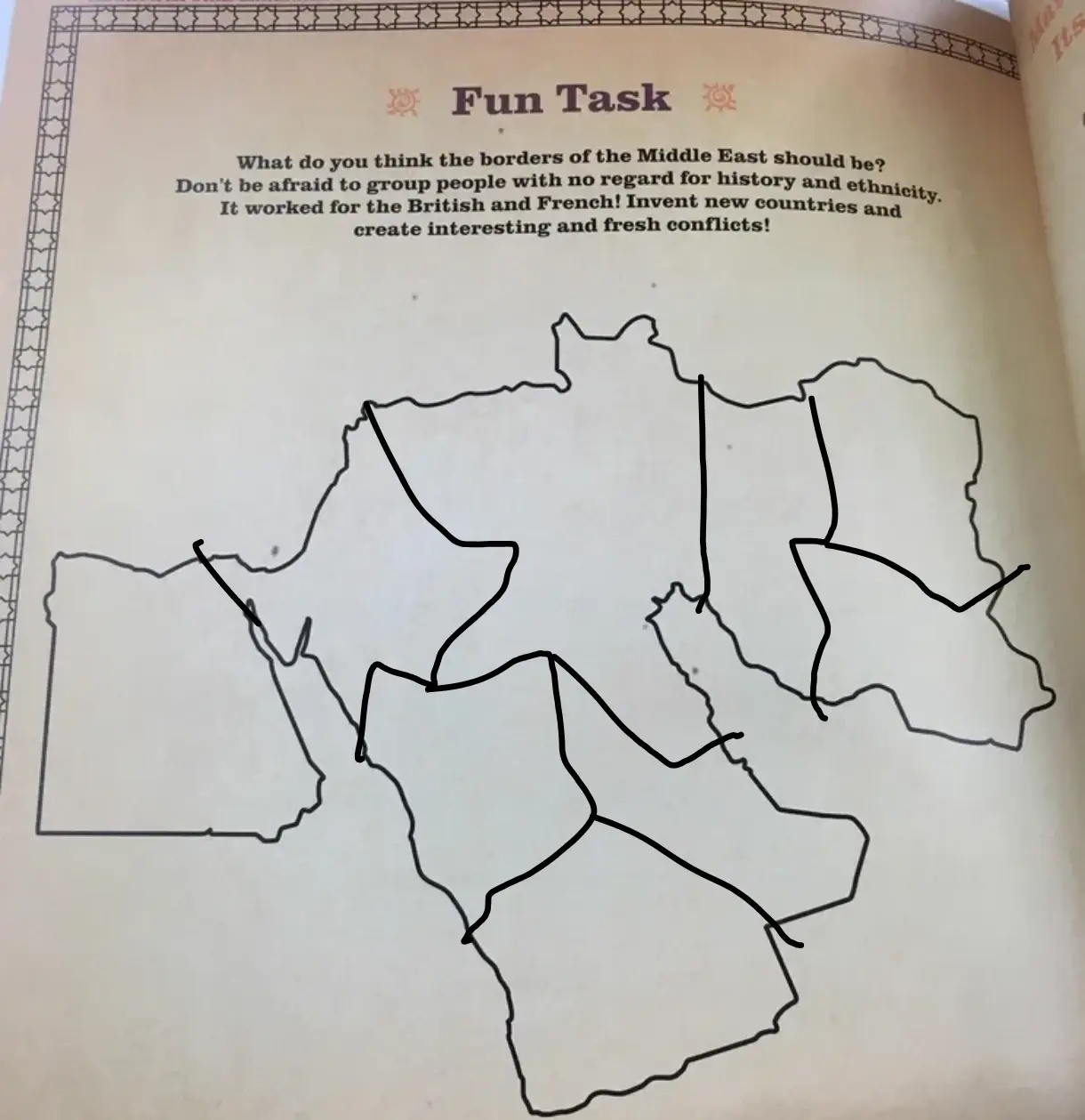
It says “no regard to history or ethnicity” but actually they were highly sensitive to ethnic differences when drawing borders.
They explicitly said the ideal was 3 ethnic groups inside the borders, with a 50:40:10 ratio. They would give power to the ‘10’ in the minority, who would ally with their western oppressors to maintain their position of privilege. The ‘50’ and ‘40’, now the underclasses of society, would often devolve into sectarian violence.
Imperial powers found that this model gives them the maximum control over their colonies with the least amount of investment and intervention. It was brutally effective.
The best part of this exercise is the presumption that one corner of Africa isn’t part of Africa but rather the Middle East.
It’s arbitrary borders all the way down.
If you go down that route, the outer borders are of currently existing countries. “Middle east” doesn’t have precise borders and the answer of where it is changed based on who you ask to.
To be fair, there’s nowhere in name Middle East that suggests it’s restricted to a specific continent
To this day I’m not entirely sure what continent Türkiye wants to be on
It’s on Eurasia like it always has been. Other than racism there’s no reason to pretend Europe is somehow a separate continent.
There’s really only two continents anyway. America and Not America.
Eurasia, Africa, America, Antarctica and assorted islands
Afroeurasia, America, Antarctica, and Greater New Zealand
Continental double-dipping
Middle East is inherently a colonial term as it describes the area I’m respect to London, where places like India are in the Far East colonies, so these colonies are Middle Eastern.
Fully two separate continents, Northeastern Africa and Western Asia. But as far as names and identities go, Middle Eastern has stuck.
I’m sure this one will work fine

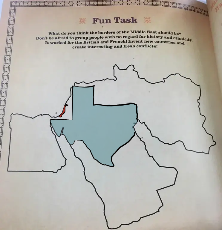
Ngl, was hoping for outline of Saddam.
If you squint hard enough, there’s probably 3 saddams near Yemen
I like how Oman is already just cut out of it.
Done
Can any geopolitical expert tell me what I’ve created?
Upper Egypt - Something that hasn’t happened in thousands of years: Lower Egypt and Upper Egypt have been divided
The Greater Levant - mostly Arab but with many minorities, and the greatest religious diversity: sunnis, shi’as, catholics, jews, alawites, druzes, coptic christians, etc.
Greater Iraq - mostly shi’a, but with an important sunni minority, and various ethnicties: Arabs, Persians, Azeris, Kurds, etc.
The others - I don’t know enough to say much confidently. I need someone else to chime in.
A powderkeg?
As opposed to what it is now?
The United States of Oh Shit, Here We Go Again.
None. New country called “Middle East”, and oh boy will it make what we have now seem stable
I’m down, let’s add it to the Schengen zone tho
And make it British 🇬🇧
+1 Independence Days
Pfft, easy. Just needs some good old fashioned American ingenuity applied to the problem.
I don’t know where I was going with this but enjoy. Someone else can fill the rest.
Erase the outside. Fuck your borders! 😄 (not at OP ofc)
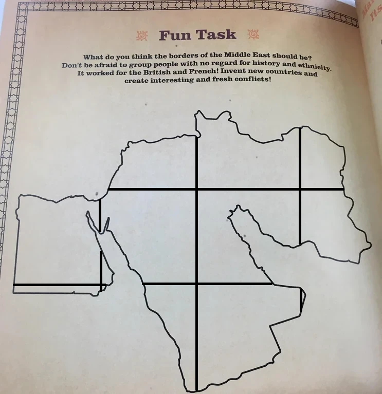
I propose dividing the area in a grid of 1m squares, and making each its own nation state. Then we wait…


