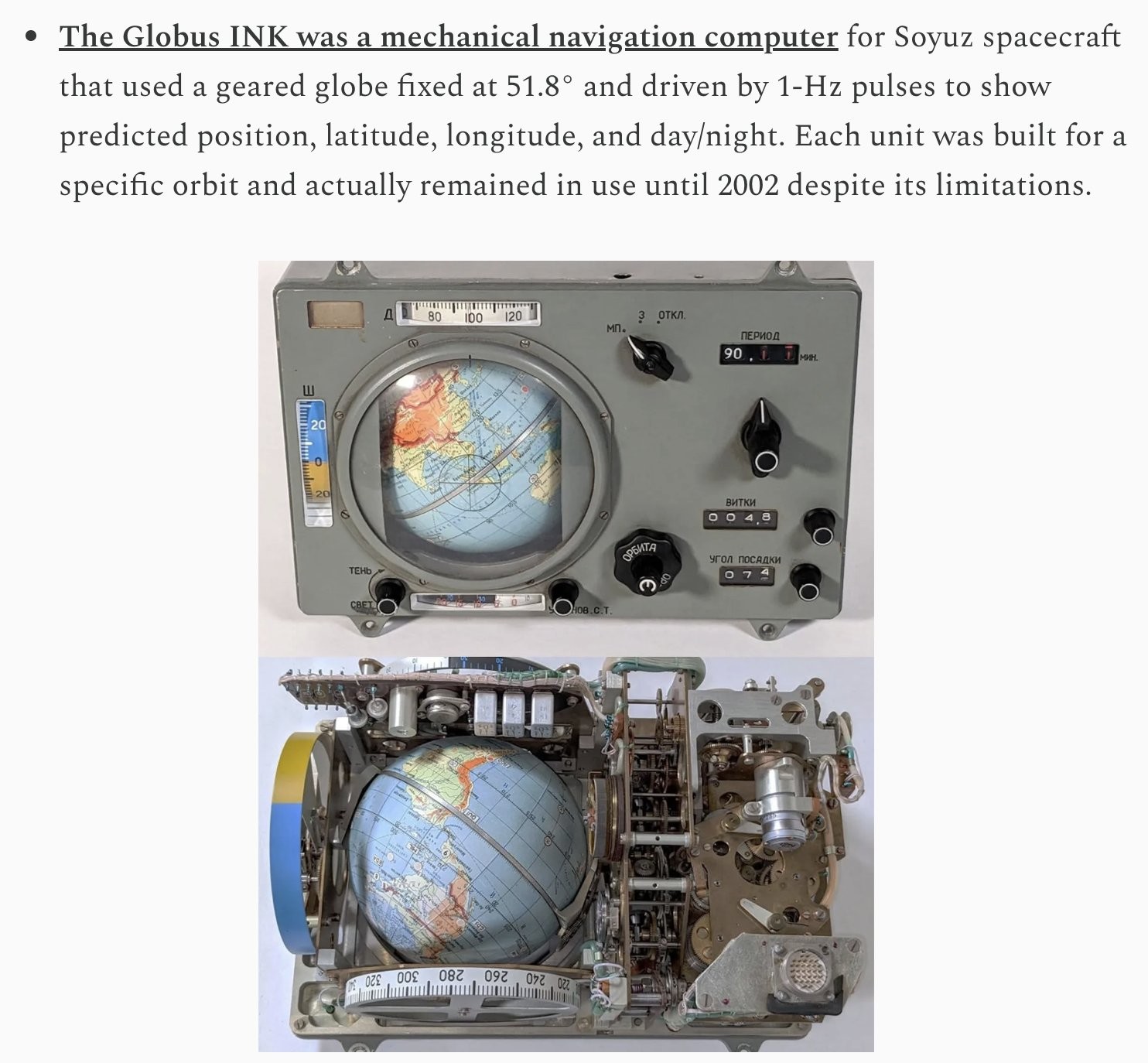
I read an article about someone restoring one that was a fascinating exploration of the technology. I believe it could also be used to predict a landing point, and the globe had an outline showing friendly nations for a preferred landing zone in case of emergency.


I read an article about someone restoring one that was a fascinating exploration of the technology. I believe it could also be used to predict a landing point, and the globe had an outline showing friendly nations for a preferred landing zone in case of emergency.
EDIT: I think this is the post I read
How often it was updated?
I would assume just as needed before a mission. I don’t think it changed much during most of the Cold War.
Space diplomacy is different than regular politics. Most of the world works together and are friendly.
It would be cool to see a map