
You must log in or register to comment.
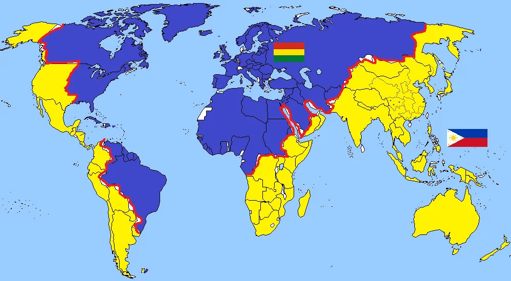
So I’m guessing this is a map that divides the world into who’s closer to the Philippines, and who’s closer to Lithuania… except they’ve got the stripes of the Lithuanian flag mixed up and accidentally used Bolivia’s
It’s the flag of Ethiopia, showing the Pan African Colours.
Clearly Lithuania and Bolivia teamed up to invade half of the world. This is the flag for the empire of Lithuivia.
Ah, yes, the middle east has historically all been fighting on the same side, and there’s absolutely no reason to believe right now is any different.
Brazil and Venezuela on the same side, but all of South America on the other side. The US is divided East/West instead of North/South. The contested territories on Africa remain contested despite everybody around them agreeing. India and China are on the same side, Russia is mostly on the other, and Siberia is cut on the very accessible planes instead of big rivers and hills…
I honestly have no idea where the author was going with this.
Finally an explanation for the animosity between India and Pakistan